Sunday, May 26, 2019

11 miles around Bangor, and a Bald Eagle outside Masons

My older son had a light running day today (11 miles, I rode bike support) so we explored the Kenduskeag Stream Trail, Bangor City Waterfront Trail, and Brewer Waterfront Trail.  The highlight was an immature bald eagle sitting above the Brewer Waterfront Trail, right next to the very popular Masons Restaurant.

Here is a trail map of our trip.


The small dot in the tree above my son's head is the bald eagle.  To the right is the outside seating at Masons.
Close up of the eagle.
The eagle taking flight.

The Kenduskeag Stream goes through a series of low falls shortly before it passes under I-95.
 
Scenic garden at Brewer Waterfront.
Woodchuck off Bangor Waterfront Trail near casino.


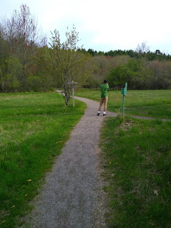
Fields Pond Aububon Center

Fields Pond Audubon Center is a 212 acre sanctuary owned by the Maine Audubon Society adjacent to a 191 acre pond.  The Center provides hiking and bird watching opportunities as well as a boat ramp and educational center.

My older son and I visited Field Ponds last night to do some light hiking and bird photography.

One of the trails is crushed gravel and connects with woodland trails.  Other trails are mowed grass of various lengths.  We picked up a tick on our hike despite staying on the trails.

Here is a map of our hike.


Inland Hospital Trail

Northern Light Inland Hospital is a small, well-managed community hospital in Waterville, Maine.  As part of its commitment to its community, the hospital has established a short yet scenic trail in the 17 acres of woods behind its main campus.  The trail connects to a larger trail system owned by the city.

My son and I were visiting Waterville yesterday and decided to explore the Inland Hospital Trail.  Signs throughout the hospital campus provide clear directions to the trailhead.   The trailhead has an informational kiosk and plenty of parking.  The trail itself was well maintained and included a number of signs encouraging activity as part of the "5-2-1-0" program.

We only had limited time and intended to stick to just the Inland portion of the trail system and hiked only around 1/4 mile (here is our trail map).  After the fact I checked a map of the trail on Maine Trail Finder (see https://www.mainetrailfinder.com/trails/trail/inland-woods-trails-and-pine-ridge-loop) and noted that the trail is actually 1 mile in length.


The trails are well-maintained.
The trailhead is directly behind the hospital, with plenty of parking. 

Saturday, May 25, 2019

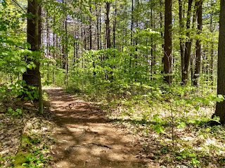
Predation at Reeds Brook Trails

Because of its dense brush, the Reeds Brook trails make for great bird watching.   My older son and I set out to do just that last night.   While watching two song birds interacting on the ground 10 feet in front of us, we were surprised by a hawk which swooped down, grabbed one of the birds and carried it off to a nearby tree.

Seconds before, the bird under the hawk's right claw was flapping around on the ground, 10 feet in front of us.

Tuesday, May 21, 2019

Tiny Ecosystems

There is a tendency among hikers and other outdoor enthusiasts to seek out spectacular views and sightings of large animals such as moose and bear.  Sometimes, however, it can be fun to focus on the tiny dramas that are playing out all around us, courtesy of insects and arachnids.


 This was taken in my yard.  I love the way it is clinging to the blade of grass.

Dragonflies are one of my favorite insects and are critical in controlling mosquito populations.  This was near Abol Bridge.

This spider was slightly smaller than my hand, and did not seem happy to have his picture taken.  This was also near Abol Bridge. 

The gold specks on this bee are pollen from the dandelion.  This was also from my yard.


Sunday, May 19, 2019

Kennebec River Rail Trail

The Kennebec River Rail Trail (KRRT) is a 6.5 mile paved rail trail running from Augusta to Gardiner and passing through the towns of Hallowell and Farmingdale.  The trail runs alongside railroad tracks and the Kennebec River and provides a great place to run, walk and cycle. 

My son's marathon training program called for a 20 mile run today, so we chose the KRRT for this and I rode support on a bike.  There were a decent amount of people out using the trail considering it was a cloudy, lightly raining Sunday morning. 

The trail offers views of the river and there are multiple access points along its path.  We started at the parking area for Maine State Housing Authority under the Route 202 bridge.  There is a section where the trail stops and you travel along Water Street in downtown Hallowell, and then it resumes after the downtown area. 

There are multiple places to stop and eat along the way, and Granite City Park in Hallowell has nice chairs to relax and watch the river.  

Here is a link to the trail map for just the Kennebec River Rail Trail.  Here is a link for the full 20 miles that we did, which includes the Augusta waterfront and doubling back on the rail trail.
The trail runs along the Kennebec River and adjacent to railroad tracks.
There are occasional benches overlooking the river.
Two very small waterfalls are visible from the trail.


The trail runs through downtown Hallowell.
Chairs overlooking the river at Granite City Park in Hallowell, next to the trail.

Saturday, May 18, 2019

Camden Hills State Park - Mount Megunticook

Today was the third time I've visited Camden Hills this year, and the second time I've hiked up Mount Megunticook.  We had planned on hiking Mount Battie with a small hiking group from work, but when one of our group decided to turn back, we elected instead to visit Megunticook, as it offers better hiking and views.

We lucked out as the rain and clouds held off and we were able to complete the hike in a mix of sun and clouds with 60 degree temps.  Black flies have started but were generally manageable.  Trail conditions were mostly dry with a couple of muddy and wet spots.

Here is today's trail map.


Sunday, May 12, 2019

MOFGA BSA Camporee in Unity

The Maine Organic Farmers and Gardeners Association and the Waldo District BSA hosted a camporee at the MOFGA fairgrounds in Unity this weekend.  A camporee is like a jamboree, but with camping and no jamming. 

The event provided an opportunity for the scouts to work on five different merit badges (animal life, plant life, gardening, metal working and farm machinery) with MOFGA staff providing excellent instruction in each.  We completed a service project as well, helping to build wooden beam fences.

Our troop had five boys (including my younger son) and three adult leaders.  We lucked out with great weather Saturday and Sunday. 

Considering the heavy rains all day Friday, the grounds were fairly dry.

For our service project, the scouts built this wooden fence..

Hands-on animal science, listening to a cow's heart and stomach.


The gardening merit badge was very popular, thanks mainly to a very engaging MOFGA staff member.

The great thing about being an adult on a scouting trip is that there is plenty of downtime.  Sure, I could have (should have) been applying sunscreen, but instead why not take some pictures of clouds...

and cool looking bugs...

and interesting Stonehenge like pillars.


Saturday, May 4, 2019

Webster Avenue in Bangor

Webster Avenue is a short paved path leading to the Bangor Municipal Golf Course from Cole's Transportation Museum that is closed to motor vehicles. 

Although short, the trail is great for kids, as it offers opportunities to explore outdoor exhibits (including a tank and helicopter) at Cole's Transportation Museum, and if timed properly, incoming flights into Bangor International Airport, since the golf course sits right in the flight path. 

I took my younger son here today after spending the afternoon looking at planes at the airport.  It was a nice way to wrap up an airplane themed afternoon. 

Here is the trail map.

Incoming flight into Bangor Airport, viewed from Webster Avenue

View of the tank exhibit at Cole's Museum
The path is a section of Webster Avenue that is closed to traffic.

Bike Ride - Route 2 from Milford to Greenbush

Route 2 north of Old Town is flat, straight, lightly traveled and has a decent shoulder most of the way to Howland (with the exception of a short stretch).  It runs alongside the Penobscot River much of the way. 

Last summer my son and I completed a 50 mile round trip ride from Old Town to Howland.  Today my son needed to run 18 miles so we selected Route 2 from Milford to Greenbush for the run while I rode and supported him. 

Here is a map of today's ride.

Route 2 runs alongside the Penobscot River part of the way

This was a nice little area at around the halfway point where I stopped and stretched my legs

A view of the river from one of two boat ramps on our route

View showing the wide shoulders and proximity of the river