Saturday, February 29, 2020

Veazie Historic Dam Site

The Veazie Historic Dam site is a small park located along the Penobscot River in Veazie at the former site of the Veazie Dam.  The park has a number of interpretive signs that explain the human and natural history of the site and provides excellent views of the Penobscot River.  

My older son and I visited the park today to do photography.   Here is a map of our hike.


Hermon Recreation Trail and ITS84

The Hermon Recreation Trail is a 2 mile trail that connects Hermon High School with the elementary school.  It's a wide trail that passes through woodlands.  I last visited the trail on November 23, 2019 with my son.

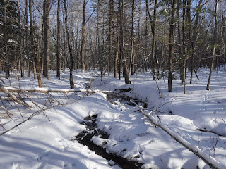
Today the trail was covered with firmly packed iced over snow.  I worn ice cleats and walked atop the snow without sinking in.  Having started my hike at 6 am in 14 degree temperatures, I had the trail to myself.

ITS 84 is a snowmobile trail that bisects the Hermon trail approximately 1/2 mile in.  I walked a little in each direction until I could see houses and then turned around.  I did not see any snowmobilers on the trail.  

Here is a map of my hike.

Sunday, February 23, 2020

Howard Mendall Wildlife Management Area (Frankfort)

I've driven past the Howard Mendall Wildlife Management Area countless times but today decided to stop and explore it on my way back from Fort Point. 

There is a short 1/4 mile path that leads from 1A to the South Branch Marsh River.  Most of the path can be driven by a four-wheel drive vehicle.  The preserve provides nice views of the river as well as surrounding mountains. 

Here is a map of my walk.


Fort Point State Park (Stockton Springs)

I visited Fort Point State Park today to watch the sunrise. I last visited Fort Point in August with my son to watch seals (https://welcome.hikingmaine.org/2019/08/seal-watching-at-fort-point-state-park.html).  It was significantly warmer at that time.

The main road leading into the park is closed in the winter so to access the park you can use the alternative parking lot located at the end of Lighthouse Road. 

The park provides excellent views of the water, forested trails, a pier, a beach area (very strong currents), a historic fort and a lighthouse.  

Here is a map of my hike.


Saturday, February 22, 2020

Sunkhaze Meadows NWR, Johnson Brook Trail

Sunkhaze Meadows National Wildlife Refuge consists of 11,484 acres of forest, peatland, and streams.

The Johnson Brook Trail is a 4 mile trail on the east side of the refuge featuring woods and wetlands on relatively flat terrain.  From the parking lot, it starts as a relatively wide trail but narrows after the first stretch of trail.  The trail today was covered with several inches of snow so I elected to snowshoe.  Parts of the trail are raised boardwalks presumably to cross wetland areas that today were covered in snow.  The northwest tail section of the trail was not well maintained with several downed trees making travel difficult.

Here is a map of my hike.


Sunday, February 16, 2020

Essex Woods (Bangor)

I visited Essex Woods in Bangor today and hiked the Loop, Molly Lane and Jennifer Lane Trails.   Essex Woods consists of approximately 70 acres of forest and wetlands and includes a sledding hill and dog park.  The area is popular for hiking, sledding and mountain biking. 

The park lacks a remote feel due to its proximity to I-95 but offers a convenient place to hike within the city. 

I visited today to see if it was possible to hike from Essex Woods to Bangor City Forest along the old Veazie railroad bed, but there is private property separating the two parks and no trespass signs posted. 

Here is a map of my hike. 

The old Veazie Railroad bed, now the Molly Lane Trail

View of the sledding hill across the marsh, adjacent to I-95

The Jennifer Lane trail runs adjacent to I-95
Sledding hill from the top
Loop Trail


Saturday, February 15, 2020

Ecotat (Hermon)

The last time I was at Ecotat, it was August and my son and I spent an hour exploring the gardens and taking pictures of flowers and insects.  We hadn't explored the trails at that time. 

Today I returned solo, enjoying the fact that the weather had warmed substantially since the morning (it was minus 16 when I woke up and by the time of my afternoon hike had warmed to a balmy 19 degrees above).  I hiked on the outer perimeter trails for a little over 0.8 miles.  The trails were not marked, although they appeared to be clearly delineated and there were signs at trail intersections.   There was only one set of footprints which appeared a few days old.  There was, however, a large number of animal tracks throughout the preserve. 

Here is a map of my hike.


There are a number of interpretive signs throughout the preserve.
 

Thursday, February 13, 2020

Mount Will Trail - North Ledges (Bethel)

The Mount Will Trail is located in the Bethel Town Forest and consists of three sections.  Most of the trail is wooded, but there are beautiful views of the Androscoggin Valley from the North Ledges.

I snowshoed to the North Ledges and back for a round trip of approximately 2 miles.  The trail was well packed and moderately steep in sections.  I could have continued over the top of Mount Will to the South Ledges but opted not to after reading reviews on AllTrails warning of ice and steep sections.   


Sunday, February 9, 2020

Central Penjajawoc Preserve (Bangor)


My son and I went hiking at the Central Penjajawoc Preserve in Bangor today.  The 265 acre preserve, owned by the Bangor Land Trust, consists of mixed forests and fields with views of Penjajawoc Marsh.  

The trails are well marked with small diamond shaped Bangor Land Trust signs.   

The parking lot was not plowed and has a sloped entrance, making exiting onto Essex Street a challenge, even with an all-wheel drive car. 

Here is a map of our hike. 


Saturday, February 1, 2020

Witherle Woods Preserve (Castine)

Witherle Woods Preserve is a 183 acre forested coastal preserve managed by the Maine Coast Heritage Trust.   In addition to it's natural features, the preserve also has historical significance, seeing military use during both the Revolutionary War and the War of 1812.

My son and I had visited the preserve last February and returned again today as part of a boy scout trip.   The trails today were either clear or covered with ice. 

Here is a map of my walk.