Skip to main content
Search
Search This Blog
HikingMaine.Org
Covering outdoor activities in Maine and neighboring areas.
Posts
Showing posts from July, 2019
Show all
July 27, 2019
Dorothea Dix Park (Hampden)
July 27, 2019
Parenting and Physics Lessons in the Great Pond Mountain Wildlands
July 25, 2019
Kayaking the Penobscot - Hampden to Bangor
July 24, 2019
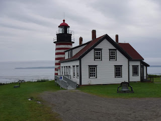
West Quoddy State Park
July 24, 2019
Campobello Island (New Brunswick, Canada)
July 14, 2019
Kayaking Seboeis Public Reserved Lands
July 14, 2019
BSA Camp Roosevelt and the Fitts Pond Trail
July 05, 2019
Hermon Pond and Souadabscook Stream
July 04, 2019
Black Mountain and Schoodic Beach, Donnell Pond Public Reserved Land
Newer Posts
Older Posts
Home